Master Backcountry Navigation: 5 Essential GPS Tips
Venturing into the great outdoors offers unparalleled beauty and adventure, but it also demands a high level of preparedness, especially when it comes to finding your way. Mastering backcountry navigation GPS techniques is no longer just for seasoned explorers; it’s a fundamental skill for anyone stepping off the beaten path. With advancements in satellite technology and user-friendly devices, navigating remote terrain has become more accessible, yet the core principles of smart and safe use remain vital.
This article will guide you through five essential GPS tips, updated to leverage today’s advanced satellite accuracy, ensuring you can confidently and safely explore the wilderness. From pre-trip planning to understanding your device’s full capabilities, these insights will help you enhance your navigational prowess and make your backcountry adventures safer and more enjoyable.
Pre-Trip Planning: The Foundation of Safe Navigation
Effective backcountry navigation begins long before you even set foot on the trail. Thorough pre-trip planning is the single most critical step to ensure a safe and successful journey, especially when relying on GPS technology. This involves not only understanding your route but also preparing your GPS device and ensuring you have reliable backups. Thinking ahead about potential challenges and how your GPS can help overcome them will make a significant difference in the field.
Start by researching your intended route comprehensively. Look at topographical maps, read trail descriptions, and check recent conditions. Identify key waypoints, potential hazards, and bailout points. Then, meticulously transfer this information to your GPS device. This might involve loading pre-planned routes, marking critical junctions, or noting water sources. Remember, a GPS is only as good as the data you feed it, so invest time in accurate data entry.
Essential Pre-Trip GPS Checklist
- Update Maps and Firmware: Ensure your GPS device has the latest map updates and firmware installed. Outdated software can lead to inaccuracies or missed features, which can be critical in remote areas.
- Load Detailed Topographical Maps: Standard base maps might not provide enough detail. Load high-resolution topographical maps that show elevation contours, water features, and vegetation, which are invaluable for off-trail travel.
- Charge Batteries and Pack Spares: GPS devices are power-hungry. Always start with fully charged batteries and carry at least one, preferably two, sets of spare batteries. Consider a portable power bank for longer trips.
- Create and Save Waypoints/Routes: Pre-mark critical locations like trailheads, campsites, water sources, and potential hazards. Create a detailed route before you go, allowing you to follow a pre-planned path rather than navigating on the fly.
- Review Settings and Calibrate: Familiarize yourself with your device’s settings. Ensure the correct coordinate system (e.g., UTM or Lat/Lon) is selected and calibrate the compass if your device has one.
By diligently following these pre-trip planning steps, you establish a solid foundation for reliable backcountry navigation GPS use. This proactive approach minimizes surprises and allows you to focus on the experience rather than scrambling to understand your surroundings when you’re already deep in the wilderness.
Understanding Advanced Satellite Accuracy and Signals
Modern GPS devices, whether standalone units or smartphone apps, benefit immensely from advancements in satellite technology. Understanding how these systems work and how to maximize their accuracy is vital for effective backcountry navigation GPS. Gone are the days of single-constellation reliance; today’s devices often tap into multiple global navigation satellite systems (GNSS) for enhanced precision.
The primary global positioning system is the United States’ GPS, but many devices now also utilize Russia’s GLONASS, Europe’s Galileo, and China’s BeiDou. By using signals from multiple constellations, your device can achieve faster fixes, better accuracy, and improved reliability, especially in challenging environments like deep canyons or dense forests where line-of-sight to a single satellite might be obstructed. This multi-constellation capability significantly reduces the margin of error, often down to a few meters.
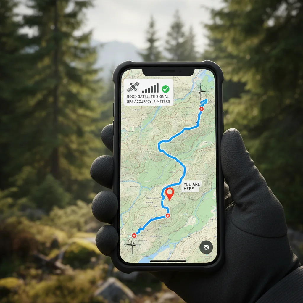
To leverage this enhanced accuracy, ensure your device is configured to receive signals from all available GNSS constellations. Many devices have a setting that allows you to choose which systems to use. Opting for a multi-GNSS approach, if available, will generally provide the best performance. Also, be aware that environmental factors like thick tree cover, steep terrain, or even heavy cloud cover can still slightly degrade signal quality, so always be prepared for minor variations in reported position.
Another factor contributing to accuracy is the use of Satellite-Based Augmentation Systems (SBAS), such as WAAS in North America or EGNOS in Europe. These systems transmit correction data from ground stations via geostationary satellites, further refining the accuracy of your GPS position. While not all devices support SBAS, those that do can often achieve sub-meter accuracy in open areas, which is incredibly useful for precise navigation and finding small features in the backcountry.
Mastering Waypoints and Routes for Off-Trail Exploration
For true off-trail exploration, simply following a pre-loaded track isn’t enough. You need to master the creation and management of waypoints and routes. These features are the backbone of effective backcountry navigation GPS, allowing you to define your path, mark critical locations, and navigate with confidence even where no established trails exist. Understanding their nuances can transform your wilderness experience.
Waypoints are essentially digital breadcrumbs—specific geographic locations that you save on your GPS device. They can mark anything from your starting point (trailhead), a hidden water source, a scenic overlook, an emergency shelter, or a tricky river crossing. Before your trip, you should pre-load essential waypoints from maps or guidebooks. During your trip, you can create new waypoints on the fly to mark anything significant you encounter, ensuring you can return to it or avoid it later.
Routes, on the other hand, are sequences of waypoints that define a planned path. Instead of just a single line, a route guides you from one waypoint to the next, often with turn-by-turn directions if your device supports it. For off-trail travel, routes are invaluable for planning a logical and safe progression through complex terrain. You can design routes to avoid steep cliffs, navigate around dense bushwhacks, or follow specific contours. Most GPS devices allow you to create routes directly on the unit or, more efficiently, on a computer using mapping software before uploading them.
When creating routes, consider using a combination of major waypoints and smaller, intermediate ones to guide you through tricky sections. For instance, if you’re traversing an open ridge with multiple false summits, marking each major rise as a waypoint in your route helps you stay on track. Always give your waypoints and routes clear, descriptive names so you can quickly identify them in the field. Regularly reviewing your planned route against your current progress on the map display is a key skill to develop for effective backcountry navigation GPS.
Integrating GPS with Traditional Navigation Tools
While GPS technology offers incredible precision and convenience, it should never be your sole navigation tool. Smart backcountry navigation GPS strategies always include integrating your electronic device with traditional tools like a paper map and a compass. This multi-tool approach provides redundancy and a deeper understanding of your surroundings, which is crucial when batteries die, devices fail, or signals are lost. Relying exclusively on technology in the wilderness can lead to dangerous situations.
A high-quality, waterproof topographical map of your area is indispensable. Before your trip, spend time studying the map, understanding the terrain, and visualizing your route. Mark your planned waypoints and routes on the paper map as well. This practice helps you develop a mental picture of the landscape and reinforces your understanding of the geography. In the field, regularly compare your GPS position to your location on the paper map. This cross-referencing helps confirm your GPS accuracy and keeps your traditional map skills sharp. If your GPS indicates you’re in a specific valley, check the map to see if the contours and features align.
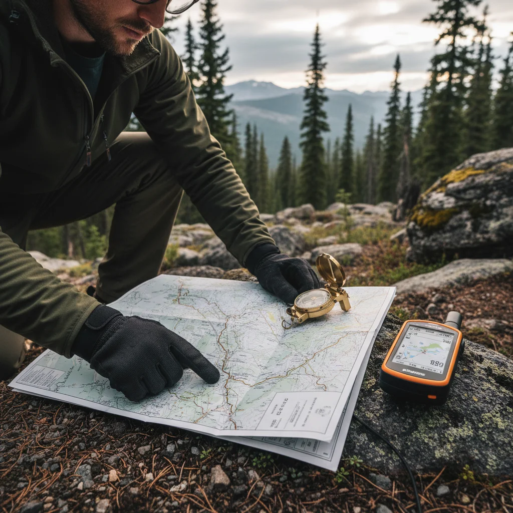
A reliable compass is the third leg of this navigational stool. While your GPS might have an electronic compass, a physical compass doesn’t rely on batteries and provides an immediate, constant bearing. Learn how to take a bearing from your map, orient the map with your compass, and use the compass to navigate to a visible landmark. In situations where GPS signals are weak or nonexistent (e.g., inside a cave, under dense canopy, or due to device malfunction), your map and compass become your primary means of navigation. Practice using them together until it feels intuitive.
The synergy between these tools is powerful. Your GPS can quickly give you a precise location, which you can then plot on your paper map. From the map, you can use your compass to determine a bearing to your next objective, or to a known landmark. This constant interplay builds confidence and ensures you have multiple ways to confirm your position and direction, making your backcountry navigation GPS strategy robust and resilient to unexpected challenges.
Maintaining Your GPS Device and Power Management
The best GPS device in the world is useless if it’s not working when you need it most. Proper maintenance and diligent power management are critical components of effective backcountry navigation GPS. These practices ensure your device remains operational throughout your entire trip, preventing frustrating and potentially dangerous situations caused by dead batteries or device malfunctions. A little proactive care goes a long way in the rugged outdoor environment.
Regularly cleaning your GPS unit is a simple yet important maintenance step. Dust, dirt, and moisture can accumulate, potentially affecting buttons, screens, or charging ports. Use a soft, damp cloth to wipe down the exterior, and ensure all ports are free of debris. If your device is waterproof, periodically check that all seals and covers are properly secured. Store your GPS in a protective case when not in use to guard against scratches and impacts, especially during transport in a backpack where it might rub against other gear.
Power management is perhaps the most crucial aspect of maintaining your GPS’s functionality in the field. Always start with fully charged batteries, and carry more spares than you think you’ll need. For multi-day trips, consider a portable solar charger or a high-capacity power bank. To conserve battery life, adjust screen brightness to the lowest comfortable setting, disable unnecessary features like Bluetooth or Wi-Fi if not in use, and set the GPS to a less frequent recording interval if continuous tracking isn’t essential. Some devices have a ‘battery saver’ mode that can significantly extend runtime.
Furthermore, understand your device’s battery life in various conditions. Cold weather can significantly reduce battery performance, so keep spare batteries warm, perhaps in an inner pocket close to your body. Avoid leaving your device exposed to extreme temperatures. Before each trip, perform a quick function check: power it on, acquire a satellite signal, and test a few key features. This ensures everything is working correctly before you head into remote areas. By prioritizing maintenance and power management, you ensure your GPS is a reliable partner for every backcountry navigation GPS adventure.
Frequently Asked Questions
Q: Can I rely solely on my smartphone for backcountry navigation?
A: While smartphones have powerful GPS capabilities, relying solely on them is risky. They are more fragile, have shorter battery lives, and can struggle with signal in very remote areas. Always carry a dedicated GPS device or a map and compass as a backup.
Q: What’s the difference between a track and a route on a GPS?
A: A track is a record of where you have been, essentially a breadcrumb trail. A route is a pre-planned path consisting of a series of waypoints that guide you to where you want to go.
Q: How often should I check my GPS position?
A: The frequency depends on the terrain and conditions. In complex or low-visibility areas, check frequently (every few minutes). In open, easy terrain, checking every 15-30 minutes might suffice. Always check at junctions or when visibility changes.
Q: What does ‘WAAS enabled’ mean on a GPS device?
A: WAAS (Wide Area Augmentation System) is a system that improves the accuracy and reliability of GPS signals in North America by providing correction data. A WAAS-enabled GPS can achieve greater precision, often within 3 meters or better.
Q: Should I carry physical maps even with a GPS?
A: Absolutely. Physical maps provide a broader overview, don’t rely on batteries, and are unaffected by electronic failures. They are an essential backup and complement to any GPS device for comprehensive backcountry navigation.
Official Resources
- USGS Topographic Maps
- National Park Service – Get GPS Smart
- REI Co-op – Navigation Basics
- Garmin – How GPS Works
Conclusion
Mastering backcountry navigation GPS techniques is an ongoing journey that significantly enhances your safety and enjoyment in the wilderness. By embracing thorough pre-trip planning, understanding the nuances of advanced satellite accuracy, and skillfully utilizing waypoints and routes, you lay a strong foundation for confident exploration. Remember that even with the most sophisticated technology, integrating your GPS with traditional tools like a paper map and compass is paramount, providing crucial redundancy and a deeper connection to your surroundings. Finally, diligent maintenance and smart power management ensure your electronic lifeline remains operational when you need it most.
The wilderness holds countless wonders, and with these updated tips for backcountry navigation GPS, you’re better equipped than ever to discover them responsibly. Invest in your skills, prepare your gear, and step out with the assurance that you can find your way, no matter where your adventures take you. Your next great outdoor experience awaits, made safer and more fulfilling by your navigational expertise.
